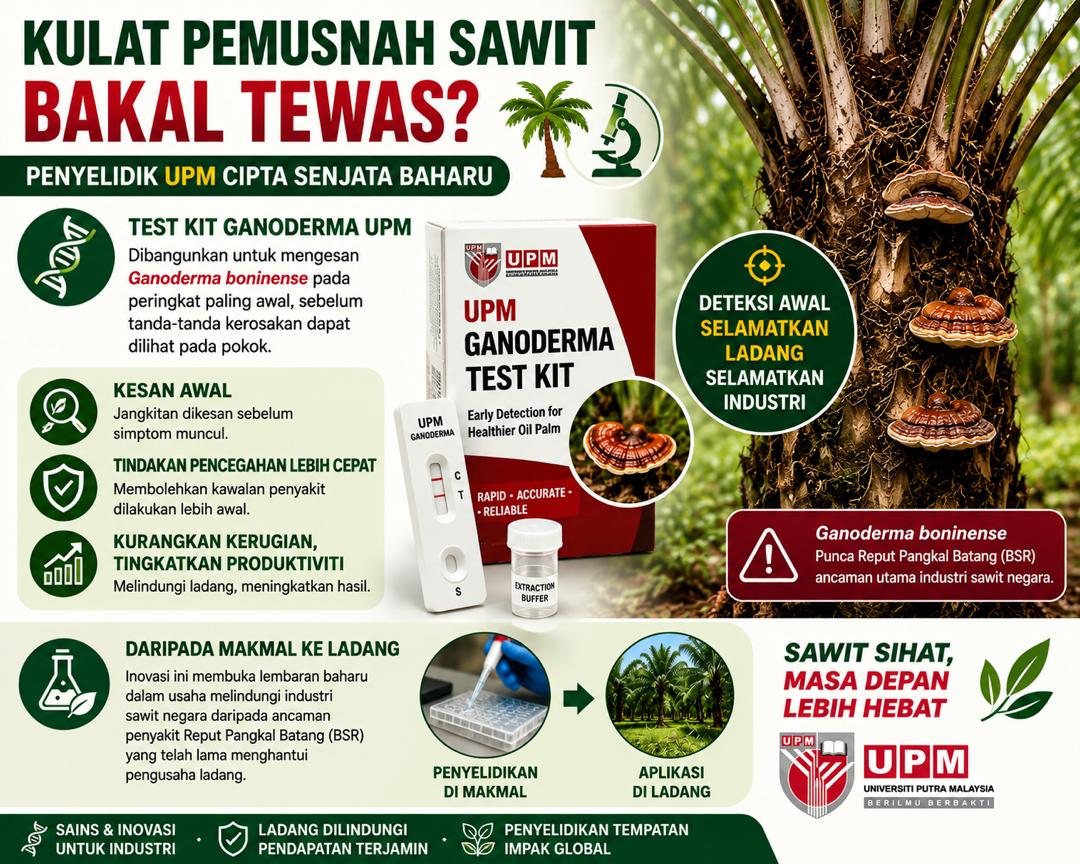
|
Landslides occur at certain slope levels over time and require practical slope analysis to assess the nature of the slope where a landslide is likely to occur. Thus, acquiring very high-resolution remote sensing data plays a significant role in determining the slope surface. For this study, 12 landslide conditioning parameters with 10 × 10 cell sizes that have never been previously collectively applied were created. These factors were created directly from the LiDAR (Light Detection and Ranging) DEM (digital elevation model) using their layer toolboxes, which include slope, aspect, elevation, curvature, and hill shade. Stream power index (SPI), topographic wetness index (TWI), and terrain roughness index (TRI) were created from spatial layers such as slope, flow direction, and flow accumulation. Shapefiles of distances to roads, lakes, trees, and build-up were digitized as land use/cover from the LiDAR image and produced using the Euclidean distance method in ArcGIS. The parameters were selected based on expert knowledge, previous landslide literature, and the study area characteristics. Moreover, multicriteria decision-making analysis, which includes the analytic hierarchy process (AHP) and fuzzy logic approaches not previously utilized with a LiDAR DEM, was used in this study to predict the possibility of a landslide.
The receiver operating characteristics (ROC) were used for the validation of results. The area under the curve (AUC) values obtained from the ROC method for the AHP and fuzzy were 0.859 and 0.802, respectively. The final susceptibility results will be helpful to urban developers in Malaysia and for sustainable landslide hazard mitigation.
|

Figure 1: Landslide location map in LiDAR orthophoto (left) and Landslide location map in DEM map (right).
|
Okoli J, Nahazanan H, Nahas F, Kalantar B, Shafri HZM, Khuzaimah Z. High-Resolution Lidar-Derived DEM for Landslide Susceptibility Assessment Using AHP and Fuzzy Logic in Serdang, Malaysia. Geosciences. 2023; 13(2):34.
Artikel penuh: https://doi.org/10.3390/geosciences13020034
Tarikh Input: 28/06/2023 | Kemaskini: 31/10/2023 | ainzubaidah
PERKONGSIAN MEDIA